
Bryce Canyon Hike: Best Trails, Miles, and Timing
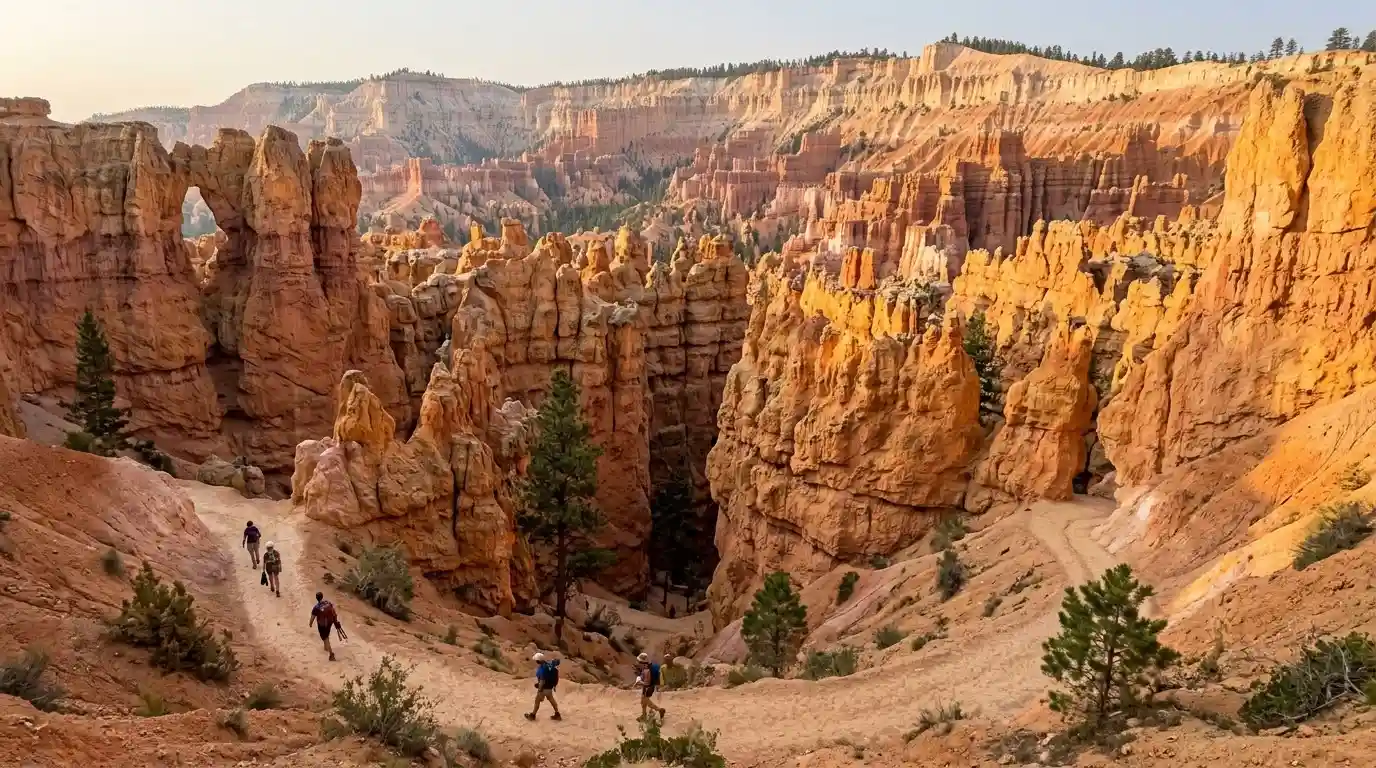
The best Bryce Canyon hike for a first visit is the Queen’s Garden and Navajo Loop combination, about 2.9 miles with roughly 600 to 650 feet of climb. Start at Sunrise Point and finish at Sunset Point. Hike early. The rim sits near 8,000 to 9,000 feet.
Bryce is a high amphitheater of hoodoos, not a wide canyon you drive through. Trails that look short on a map feel longer in thin air. Wall Street, one side of Navajo Loop, closes in winter and during some repairs, so check the board the morning you go.
Which Bryce Canyon hike should you do first?
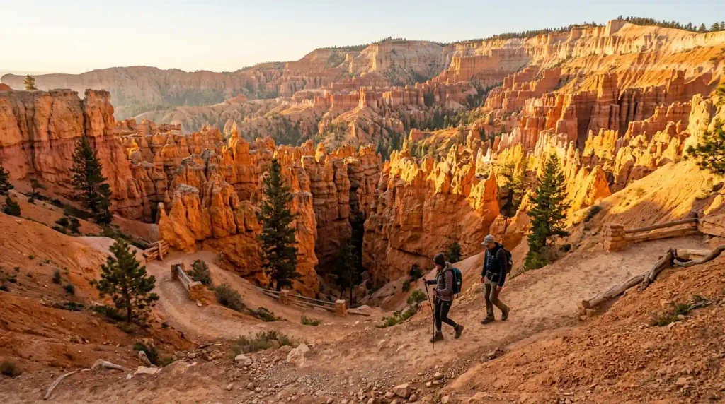
Rangers often point first timers to the Queen’s Garden and Navajo combination. The park describes it as the most popular hike below the rim. Descend Queen’s Garden from Sunrise Point, cross the amphitheater, climb Navajo Loop to Sunset Point, and walk the Rim Trail back. Plan 2 to 3 hours.
Queen’s Garden alone is about 1.8 miles round trip and the gentler way under the rim. Navajo Loop alone is about 1.3 to 1.4 miles from Sunset Point with a steep 500 foot class climb. The combo earns the morning because it joins both without a second descent.
This Bryce Canyon hike plan assumes summer or early fall conditions. Ice changes everything. Microspikes and a later start matter once snow holds in the slots.
| Hike | Distance | Climb | Time | Best for |
|---|---|---|---|---|
| Queen’s Garden and Navajo | 2.9 miles | About 625 feet | 2 to 3 hours | First visit |
| Queen’s Garden only | 1.8 miles | About 320 to 450 feet | 1 to 2 hours | Easier hoodoo walk |
| Navajo Loop | 1.3 miles | About 515 feet | 1 to 2 hours | Short steep views |
| Peekaboo Loop | 5.5 miles | About 1,500 feet | 3 to 4 hours | Longer amphitheater day |
| Fairyland Loop | 8 miles | About 1,500 to 1,900 feet | 4 to 5 hours | Quieter full hike |
| Mossy Cave | 0.8 miles | About 150 feet | Under 1 hour | Short stop near Tropic |
How hard is the Navajo Loop compared with Queen’s Garden?
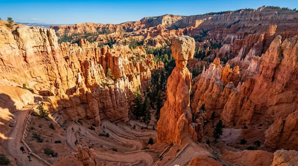
Navajo is the dramatic one. Switchbacks drop from Sunset Point toward Wall Street and Thor’s Hammer. The climb back is the part people underestimate, especially at midday in July. Queen’s Garden from Sunrise Point is more gradual and a better fit for mixed groups.
Do the combo clockwise from Sunrise if the goal is the gentler descent first. Leave water for the Navajo climb. There is little shade among the hoodoos once the sun is high. Horses and mules use parts of Peekaboo in season, so step aside when stock appears.
Hikers who want a second park with stone fins can read best hikes in Arches National Park before they drive north. The rock and the altitude are not the same test.
What shorter Bryce Canyon hikes still show the hoodoos?
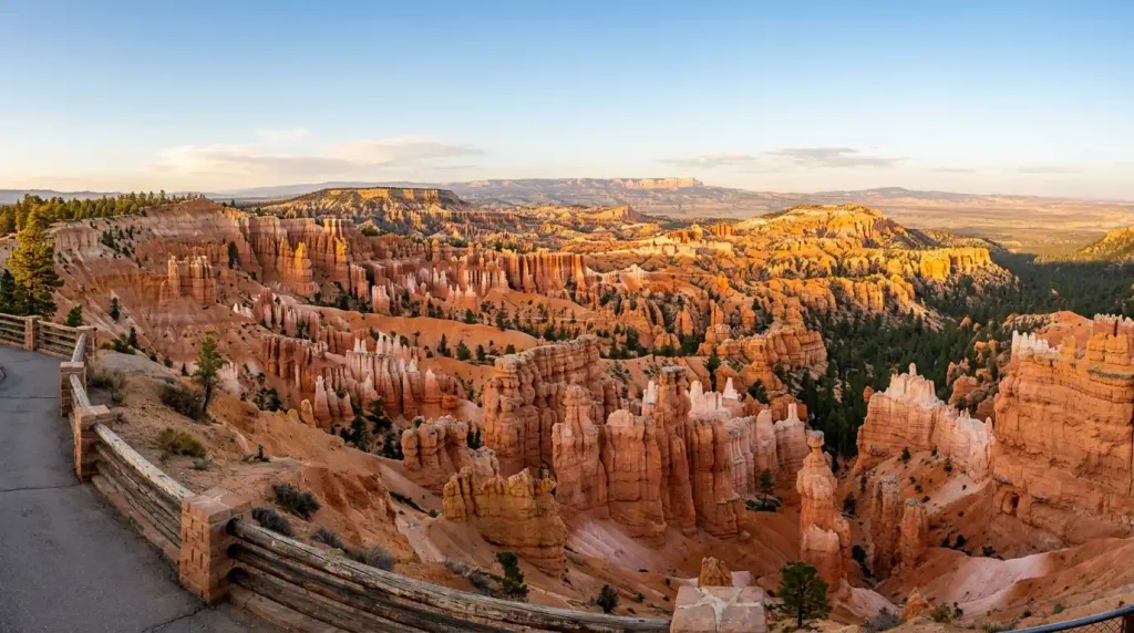
The Rim Trail between Sunrise and Sunset is about 1 mile round trip if you only walk that segment, with little climb. It is paved in places and the easiest viewpoint walk. It does not put you among the hoodoos. It puts you above them.
Mossy Cave is about 0.8 miles near Tropic, off Highway 12, not in the main amphitheater. It takes under an hour and suits a stop on the way in. Bristlecone Loop, near Rainbow Point at the south end, is about 1 mile through high forest. The scenic drive to Rainbow Point is 18 miles one way from the visitor center area, about 30 to 40 minutes.
Families who need a flat finish after Utah can compare notes with Salt Lake City Utah attractions for the city bookend of the same trip.
Which long hike is worth the extra miles?
Peekaboo Loop is about 5.5 miles with roughly 1,500 feet of climb and 3 to 4 hours. It stays inside the hoodoo scenery longer than the combo. The Figure 8, linking Queen’s Garden, Peekaboo, and Navajo, runs about 6.4 miles. That is a full hiking day at this elevation.
Fairyland Loop is about 8 miles and 4 to 5 hours from Fairyland Point or Sunrise Point. It is quieter because no shuttle serves Fairyland Point in the same way as Sunset. Tower Bridge, about 3 miles, is the shorter slice of that country if 8 miles is too much.
People building a park chain often add Rocky Mountain National Park or Glacier National Park in June on other trips. Do not treat those mile counts as a warm up for Bryce. The altitude hit is local.
How do drive times around Bryce Canyon work?
Ruby’s Inn and the park entrances sit just outside the amphitheater. Tropic is about 8 miles and 15 minutes east. Panguitch is about 24 miles and 30 minutes west, the practical supply town. Kodachrome Basin State Park is about 20 miles and 30 minutes from the Bryce area via Cannonville.
Zion National Park’s east entrance is roughly 75 miles and about 1 hour 30 minutes via Highway 12 and US 89, longer if you stop in Red Canyon. Kanab is about 80 miles and 1 hour 40 minutes. Cedar Breaks National Monument is about 70 miles and 1 hour 30 minutes toward Cedar City. Capitol Reef National Park is about 120 miles and 2 hours 30 minutes east.
A useful base comparison is must do Sedona and hidden gems in Sedona if the Southwest loop continues into Arizona. Red rock there is a different trail system. For a forest hike with sea cliffs instead of hoodoos, Acadia National Park in fall is the far contrast, and Precipice Trail at Acadia is the harder finish.
When is the best season for a Bryce Canyon hike?
May to early June and September to mid October balance open trails and cooler air. July and August bring afternoon storms and crowds at Sunset Point between 10 am and 3 pm. Winter is quiet and icy. Wall Street often closes, and the Two Bridges side of Navajo is the usual workaround.
Start at sunrise in summer. The elevation makes a 75 degree forecast feel harder on the climb. Carry more water than the mileage suggests. There are no reliable taps below the rim. Fees to enter the park change, so confirm the current federal rate before the gate.
Shoulder season packers can pull ideas from travel essentials for long flights if Bryce is the end of a bigger ticket. The last mile still needs a real layer, not a plane blanket.
What do hikers get wrong at Bryce?
They trust the short mileage and skip water. They start at noon. They miss the Wall Street closure note and have to reroute at the junction. They also drive to Rainbow Point at dusk and lose the light on the return.
Parking at Sunset and Sunrise fills on holiday weekends. The shuttle, when it runs in the main season, is the calmer choice. Pets are limited on trails below the rim. Check the current pet rule before you leave the lot.
After the hoodoos, some routes continue to Sequoia National Park or Hatcher Pass hikes on later trips. Closer park texture sits in Bentonite Hills in Utah. A gorge day with a different scale is the Columbia River Gorge itinerary. A Utah city close is must do Salt Lake City.
Final Thoughts
Do the Queen’s Garden and Navajo combination first, early, with water and a closure check. Save Peekaboo or Fairyland for a second day if the altitude felt fine. For the next Utah and Arizona layer after the rim, open best hikes in Arches National Park and match the miles to the season.
FAQ
Bryce Canyon hike
The first hike to book the morning around is Queen’s Garden plus Navajo Loop, about 2.9 miles and 2 to 3 hours. Start at Sunrise Point. Check whether Wall Street is open before you leave the trailhead.
How long is the best Bryce Canyon hike?
The combo is about 2.9 miles with roughly 600 to 650 feet of elevation gain. Queen’s Garden alone is about 1.8 miles. Fairyland Loop is the long quiet option at about 8 miles.
Is Navajo Loop hard?
The distance is short and the climb is steep. Many hikers feel it on the way up, especially above 8,000 feet in summer heat. It is a moderate trail for fit walkers and a poor choice as a midday first hike.
Can kids hike at Bryce Canyon?
The Rim Trail segment between Sunrise and Sunset is the easy family walk. Queen’s Garden is the next step if children are used to hills. Skip Fairyland and Peekaboo for young kids. Watch edges on every rim path.
What time should you start?
Sunrise in summer. The light on the hoodoos is better and the climb is cooler. Sunset Point parking gets tight later in the morning. Winter starts can wait until ice softens, if it softens at all.
Does Wall Street close?
Yes, in winter and during some maintenance. The loop is not always a loop. Use Two Bridges when Wall Street is shut and confirm the status at the visitor center the same morning.
How far is Zion from Bryce Canyon?
The east side of Zion is roughly 75 miles and about 1 hour 30 minutes via Highway 12. Stops in Red Canyon add time. Do not plan a full Zion hike after a Bryce morning unless the group is fresh.
Is Mossy Cave inside the main park?
It is a park trail, but it sits off Highway 12 near Tropic, about 15 minutes from the main amphitheater. The walk is about 0.8 miles. It is a side stop, not a replacement for the rim.
How much water should hikers carry?
More than the mileage suggests. There is little shade and no dependable water below the rim. A short combo can still take 2 to 3 hours at altitude. Refill at Sunrise or Sunset before you drop in.
Are dogs allowed on Bryce trails?
Pet rules are limited below the rim. The paved sections near viewpoints are the usual exception, and even those can change. Check the current park pet page before you unload the car.
What is the elevation at the rim?
Viewpoints along the main amphitheater sit around 8,000 to 9,000 feet. That is why a 3 mile hike can feel longer than the same distance at sea level. Slow the first hour if you drove up the same day.
Which nearby town is practical?
Tropic is about 8 miles and 15 minutes east. Panguitch is about 24 miles and 30 minutes west. Both work for supplies. Ruby’s Inn sits at the park edge for the shortest return after Sunset Point.


